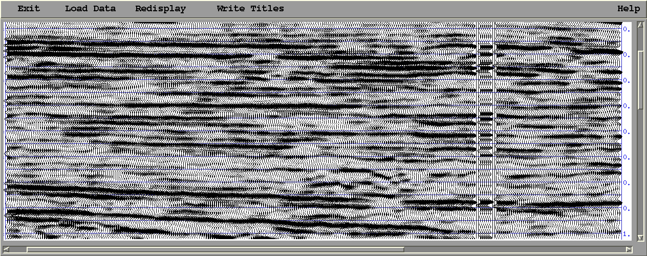
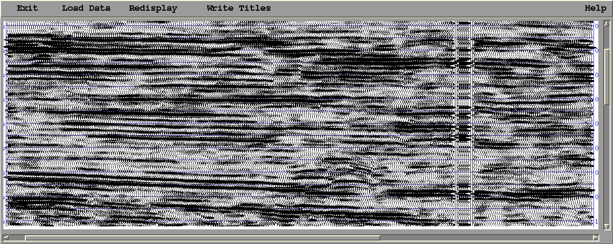
Note: Two figures are displayed below to compare the vertical resolution of the seiemic data at a well location: before (Fig. 1) and after (Fig. 2) applying geo information fusion. Fig. 2 shows a higher resolution (fine layers) than that (coarse layers) in Fig. 1.
Fig 1. Field Data: Original section,
displayed with low-resolution synthetic records at well location
Fig 2. Field Data: Result section:
displayed with high-resolution synthetic records at well location
© GSPITU/Tsinghua.