Seismic
Signal Interpretation
In Petroleum Reservoir
Exploration
|
Seismic
Signal Interpretation |
Interpretation of seismic data relies on human expertise. By applying proprietary techniques, we have developed methods for automatic seismic data segmentation and horizon tracking, seismic attributes analysis, discontinuity enhancement and seismic-based reservoir prediction and analysis, among other things.These techniques have been built into an integrated software system, Seiscriptor™, a tool that helps users analyze potential petroleum reservoirs from seismic data.
When well information is available, this tool can help reveal more detailed information on the reservoir, by predicting the important lithological parameters such as sand-percentage, sand-thickness, oil/water saturability, and so on.
Even when there is no known drillings in an area, this software can still help user analyze possible reservoir distributions by applying unsupervised analysis on the seismic data with the aid of human knowledge.
An unique neural network method, called SOMA, has been developed for specific tasks in seismic data interpretation. It has been used in a large number of oil companies in Asia. The following pictures show the interfaces of SOMA as applied to a real case.
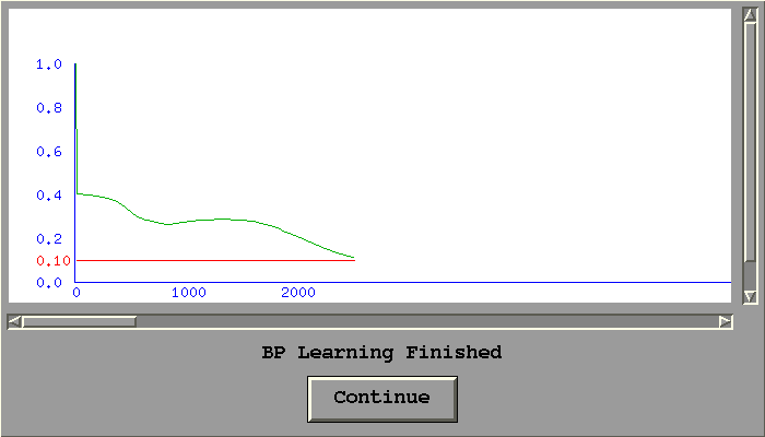
1. Neural network training (error curve) to predict lithologic parameters (click to enlarge)
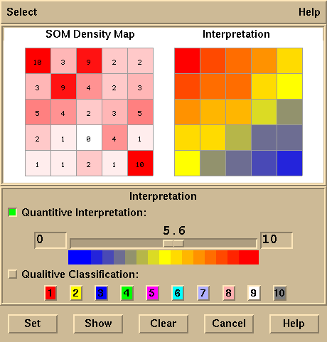
2. Cluster analysis by SOMA technique to discover clusters from the seismic data set to reveal oil distribution of potential reservoirs.
A Real-world Case
(double click on pictures to enlarge)
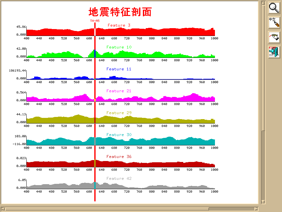
3. Seismic Feature Selection and Extraction
Multiple attributes (features) are extracted from the seismic data in a target zone. This picture shows a Seiscriptor interface to display the attributes, so that a user can perform analysis or to select a subset of features from them. The attributes are extracted from seismic data with signal processing techniques such as spectrum analysis, signal modeling, and intuitive statistics. Features thus obtained are the input for later analysis such as NN and PR. Other feature selection and extraction alghorithms, including PCA (KL transform), are also provided by Seiscriptor.
4. Multisource Information Fusion Tool
Seiscriptor offers an easy-to-use graghical tool for fusion (connection) of well information with seismic information. In reservoir exploration context, this is in fact a procedure of corelation and calibration.
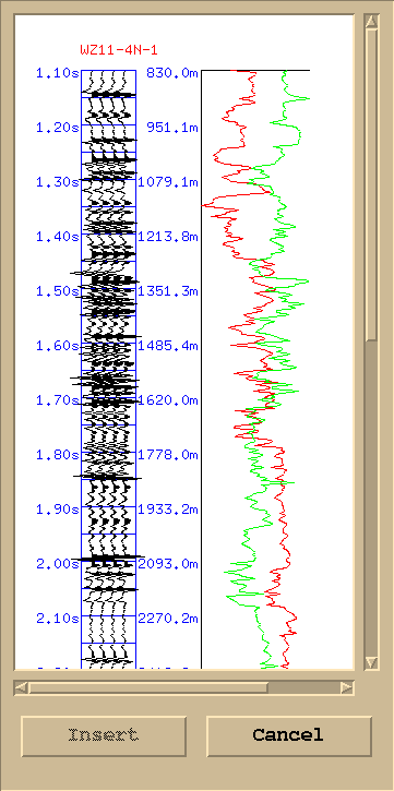
5. Synthetic Seismic Record from Well Log Data.
This is the step before well-seismic corelation. Seiscriptor gives a simple graphical tool for a user to generates "theoretical' seismic data according to the information from well-logs.
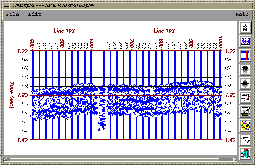
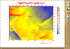
6. Depth Map (T0 map)
This is the depth map of the target layer under study. Red, yellow, and blue colors are used to indicate deep, medium and shallow.
Back to Geo Info Home, © GSPITU/Tsinghua.